Click the image once to reveal 2019 map and again to reveal 2014 map.
This slider image below offers an easy way to identify the locations with zoning changes that are shown in Master Plan 2019 (vs Master Plan 2014).
To better understand the Master Plan for Singapore, please visit the official Master Plan website.
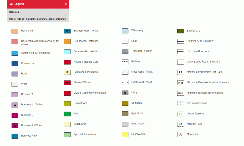
The colour box and text below offers identification for the Land Parcel Use. There are accompanying notes for each Land Use Type (pdf).